Nápověda
Seznam souborů
Skočit na navigaci
Skočit na vyhledávání
Tato speciální stránka zobrazuje všechny načtené soubory.
Seznam souborů
Položek na stránce:
20
50
100
250
500
Hledat soubor podle názvu:
Uživatelské jméno:
Zahrnout staré verze souborů
Zobrazit
První stránka
Předchozí stránka
Následující stránka
Poslední stránka
Datum
Název
Náhled
Velikost (bajtů)
Uživatel
Popis
Verze
21. 8. 2019, 23:06
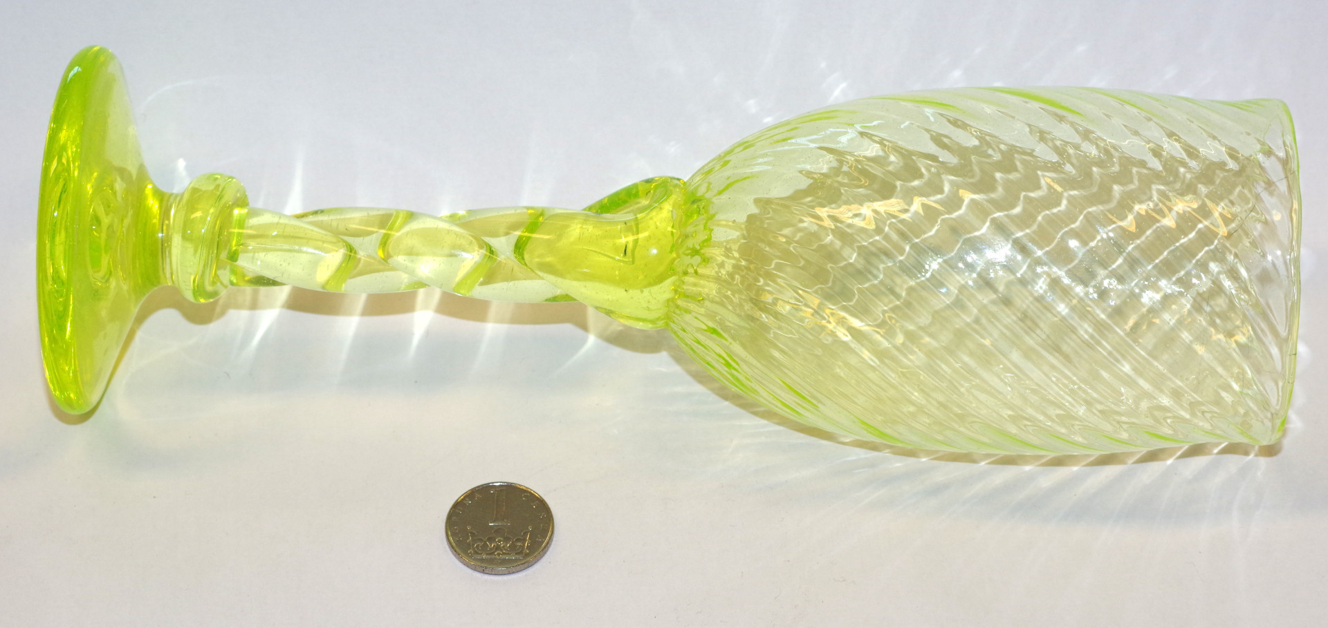
Uranove sklo web.JPG
(
soubor
)
346 KB
Jan.helebrant
1
22. 12. 2019, 19:45
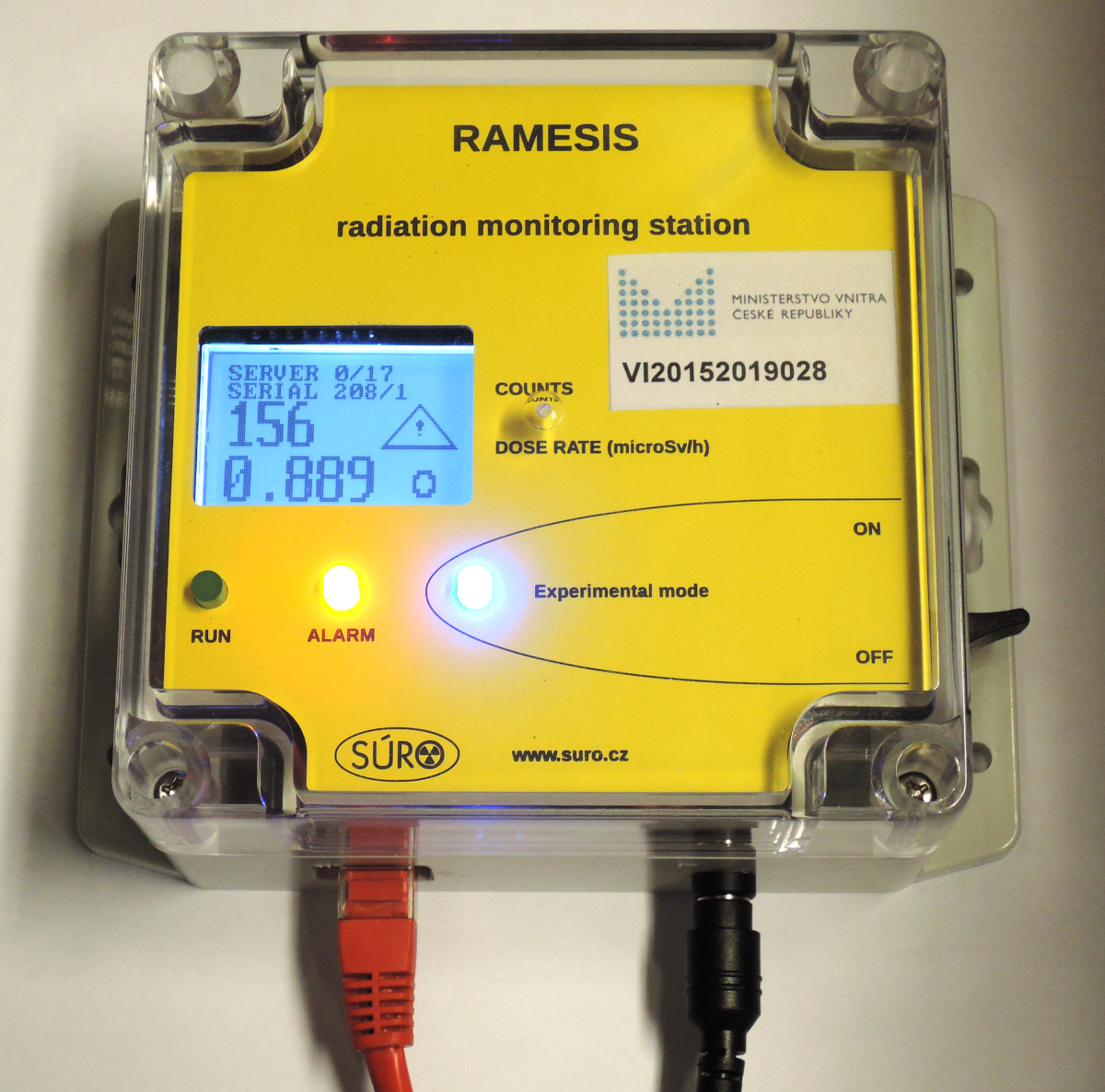
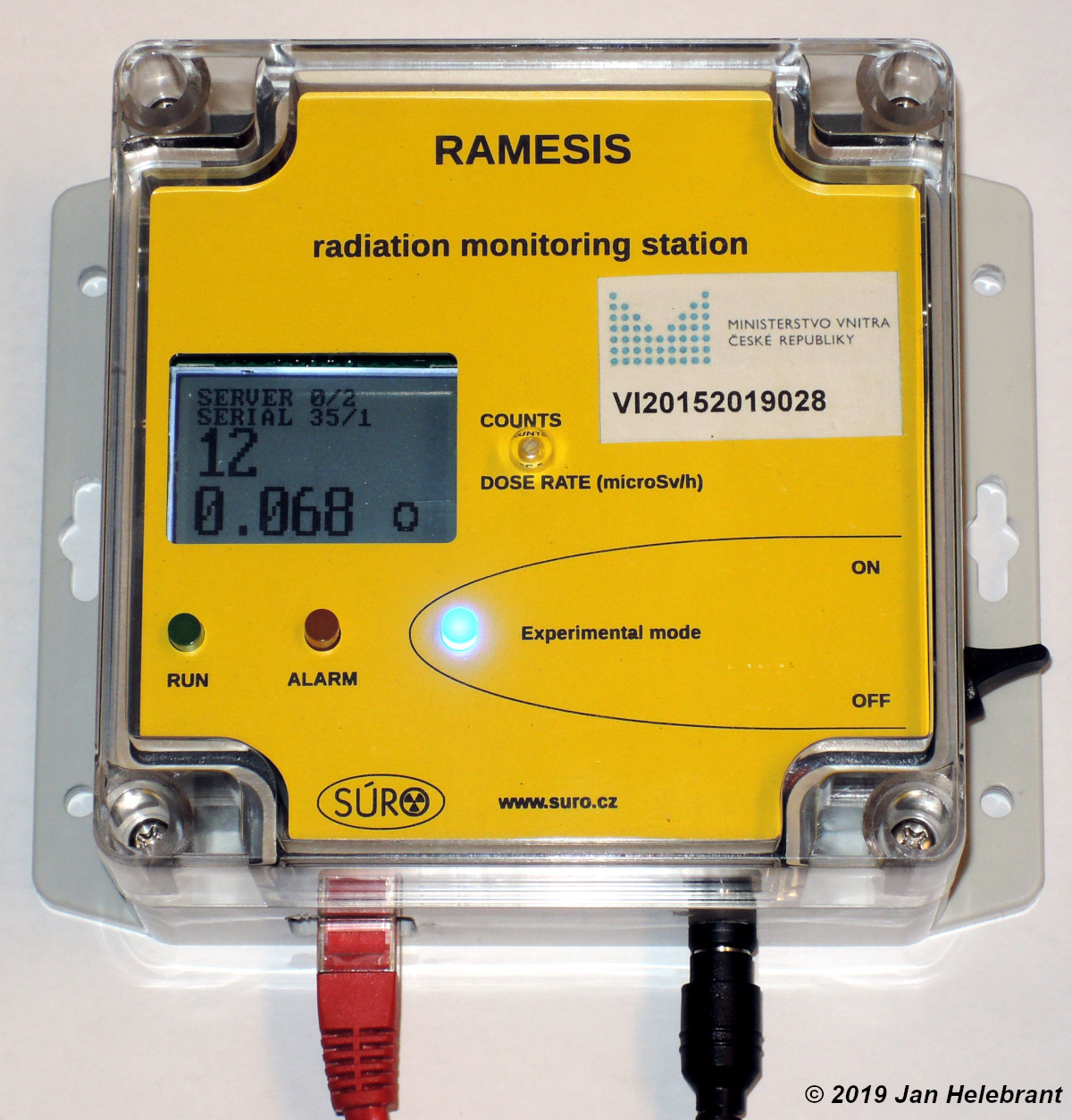
Wiki ramesis fixni stanicka alarm.jpg
(
soubor
)
347 KB
Jan.helebrant
1
21. 8. 2019, 22:59
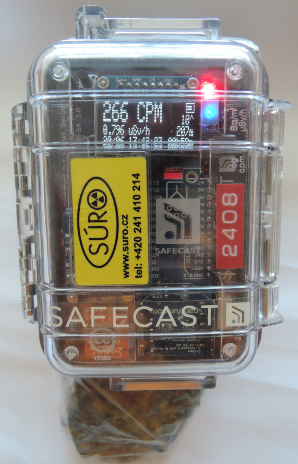
Radiobaryt safecast web.JPG
(
soubor
)
352 KB
Jan.helebrant
1
18. 9. 2017, 16:07
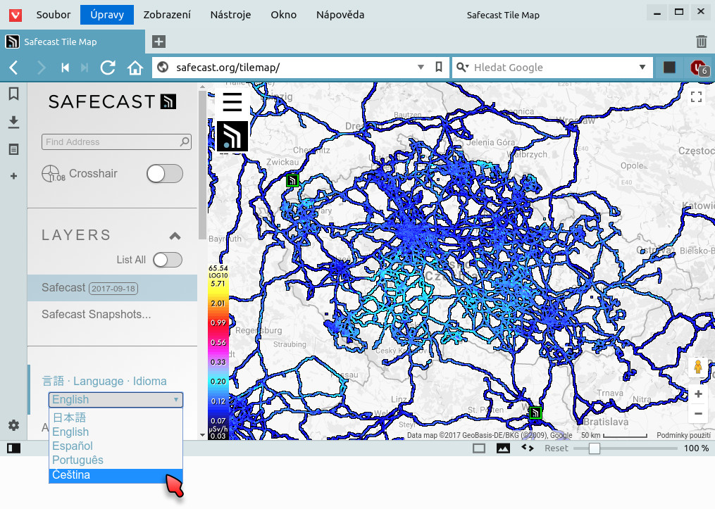
Safecast Tile Map Czech.jpg
(
soubor
)
354 KB
Jan.helebrant
2
1. 10. 2017, 23:54
QGIS Ground ukazka2 vystup.png
(
soubor
)
357 KB
Jan.helebrant
1
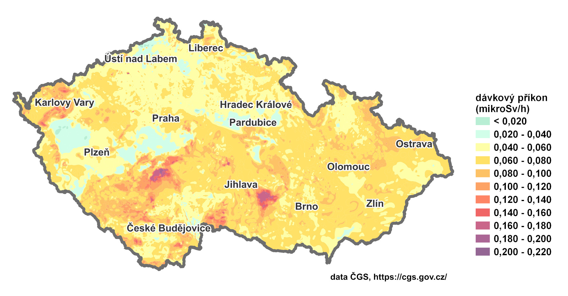
25. 1. 2024, 13:06
Radiometricka uSvh.jpg
(
soubor
)
359 KB
Jan.helebrant
2
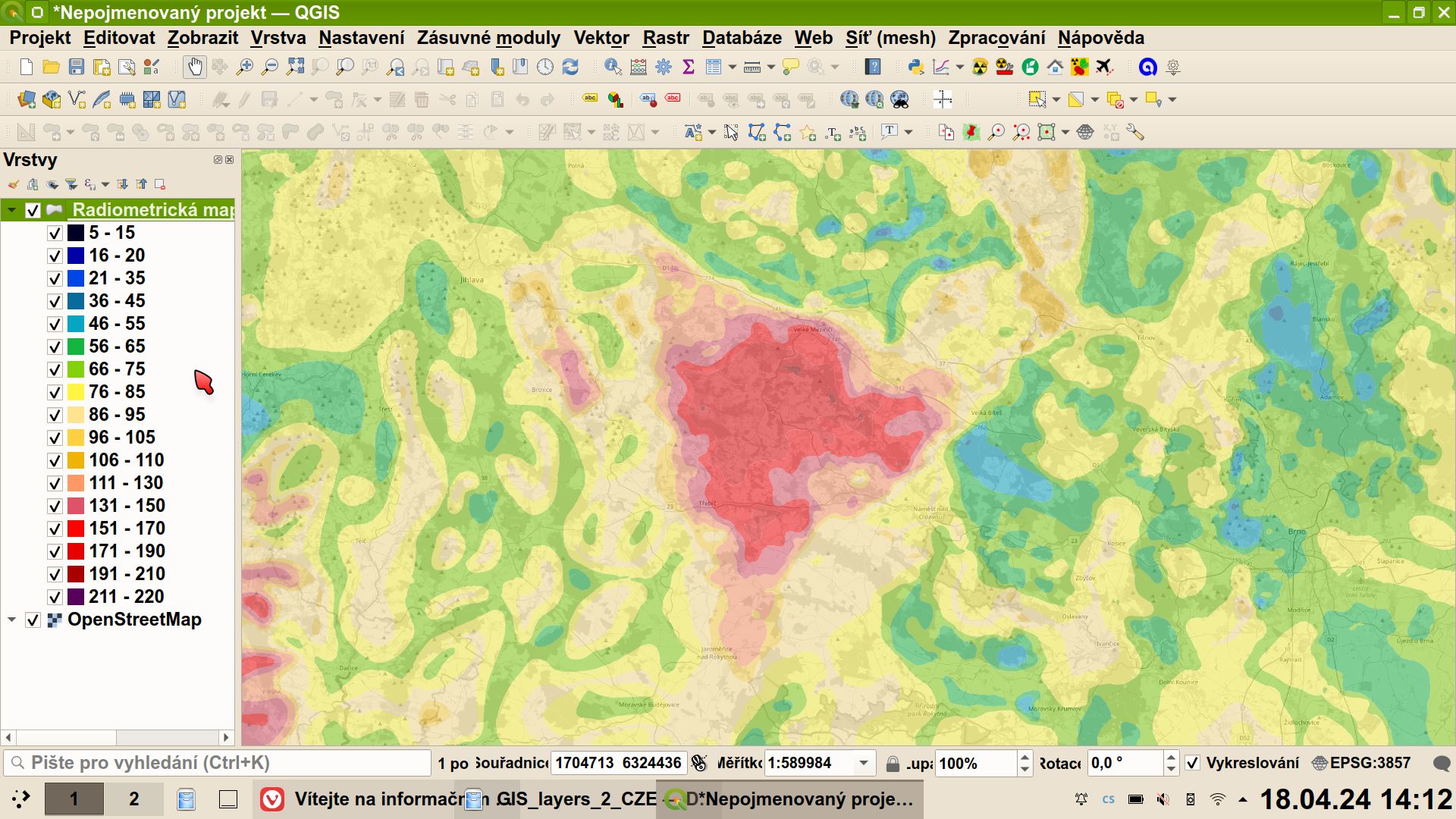
18. 4. 2024, 14:30
GIS supporting layers 005.jpg
(
soubor
)
361 KB
Jan.helebrant
1
18. 1. 2024, 15:25
Schema 02 CzechRad.jpg
(
soubor
)
368 KB
Jan.helebrant
1
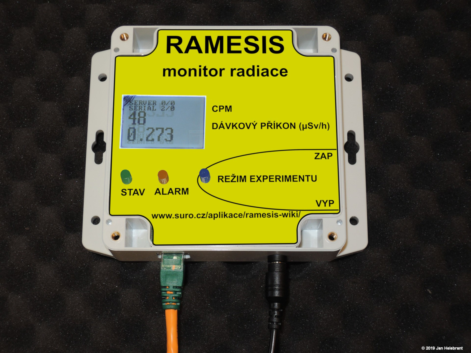
14. 8. 2019, 10:53
Wiki ramesis fixni stanicka foto.jpg
(
soubor
)
384 KB
Jan.helebrant
1
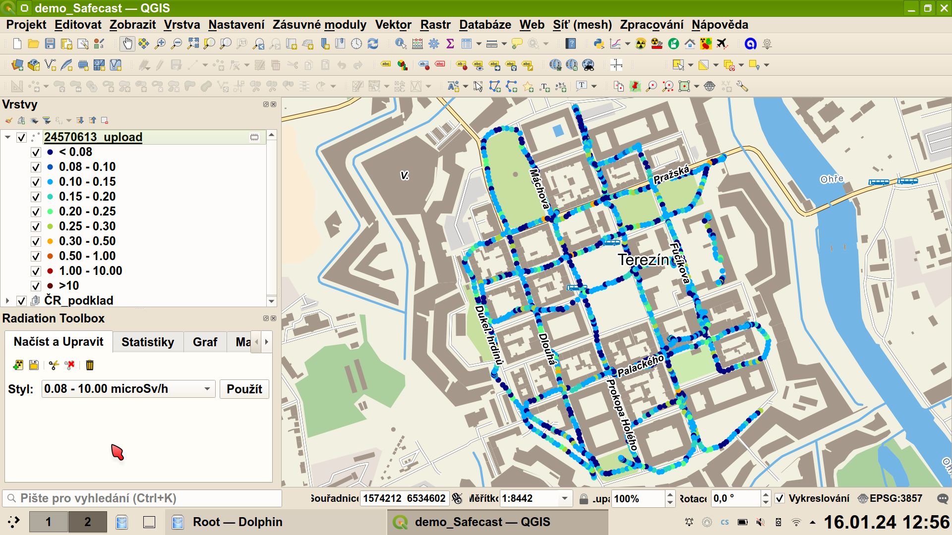
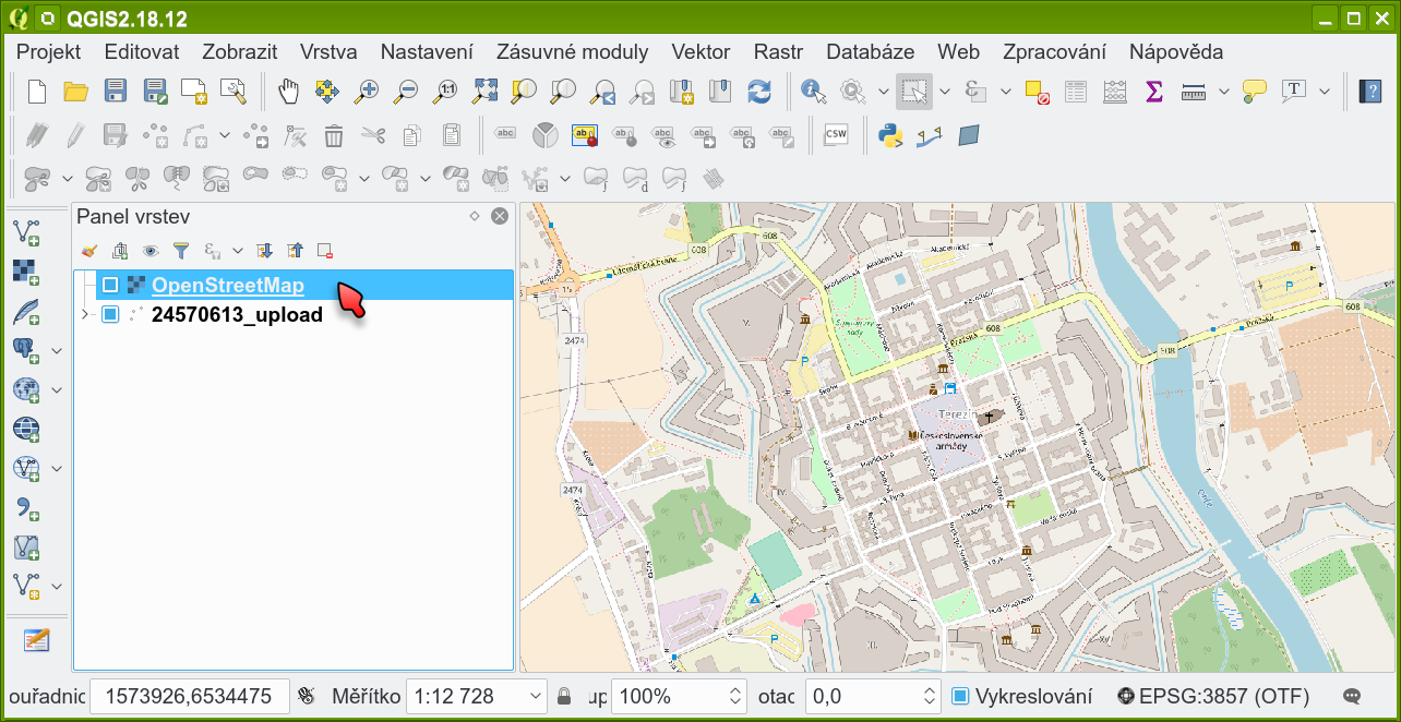
16. 1. 2024, 14:05
Safecast offline data Terezin.jpg
(
soubor
)
385 KB
Jan.helebrant
2
22. 12. 2019, 00:08
Wiki ramesis fixni stanicka foto predek.JPG
(
soubor
)
393 KB
Jan.helebrant
1
21. 4. 2020, 18:37
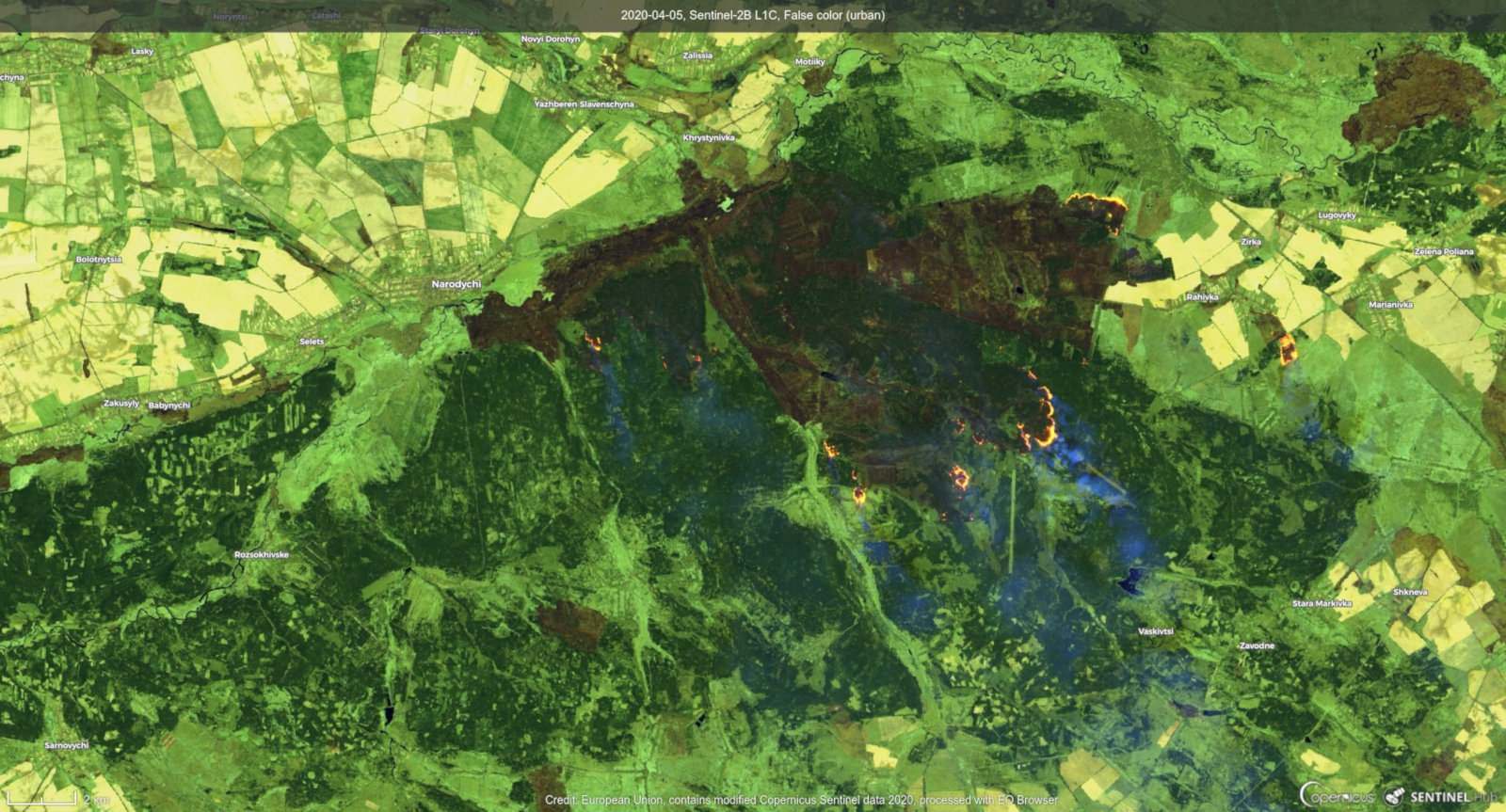
Wiki forest fire Sentinel-2B 2 False color.jpg
(
soubor
)
409 KB
Jan.helebrant
1
26. 12. 2020, 17:34
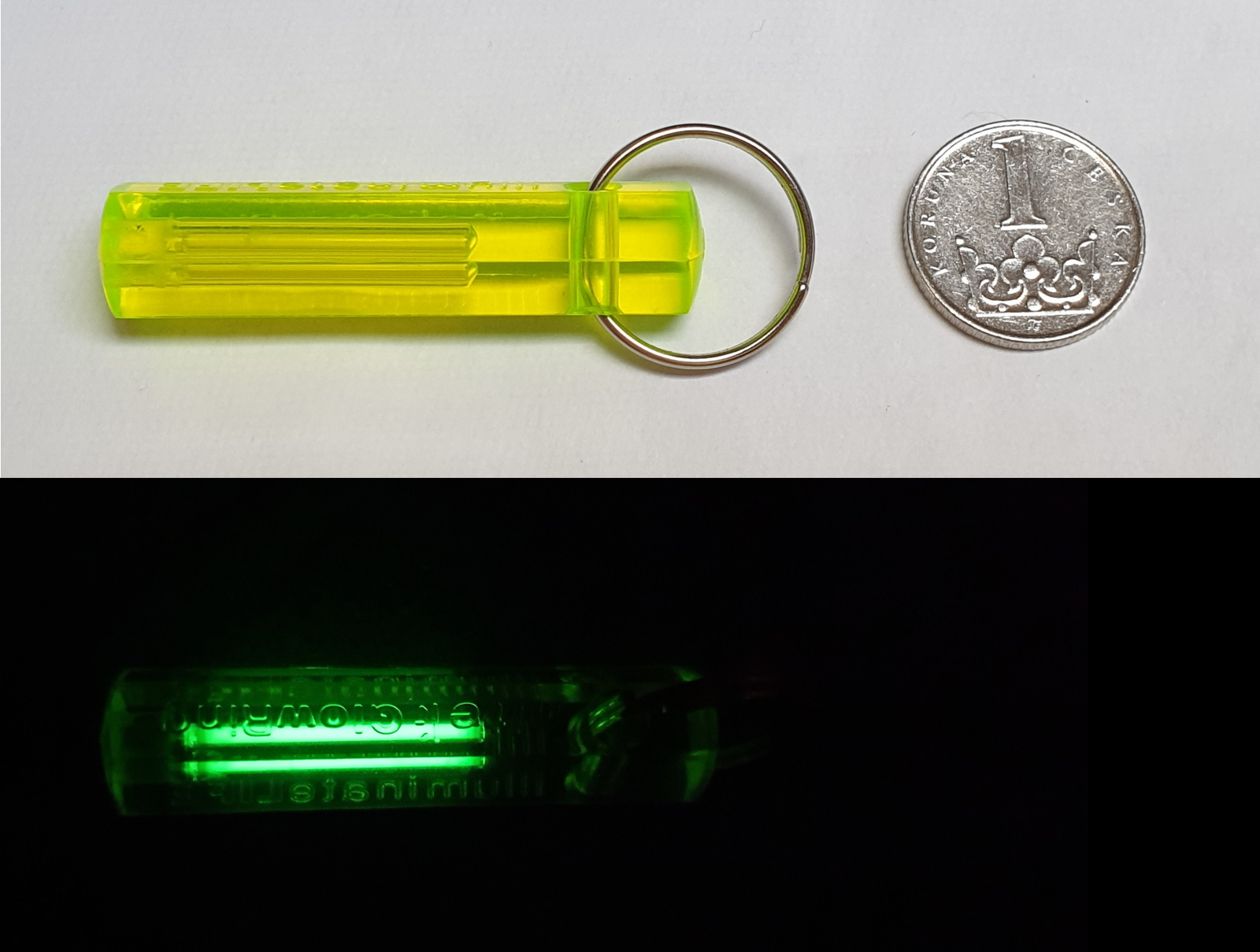
Tritium GTLS privesek.jpg
(
soubor
)
410 KB
Jan.helebrant
1
21. 8. 2017, 16:30
Safecast ukazka mapy k tisku.jpg
(
soubor
)
411 KB
Jan.helebrant
1
18. 4. 2024, 14:25
GIS supporting layers 004.jpg
(
soubor
)
419 KB
Jan.helebrant
1
20. 2. 2020, 00:00
QGIS3 001 pridat WMS.png
(
soubor
)
428 KB
Jan.helebrant
1
1. 9. 2017, 15:33
QGIS Safecast OpenStreetMap.png
(
soubor
)
435 KB
Jan.helebrant
1
1. 9. 2017, 15:21
QGIS OpenStreetMap.png
(
soubor
)
441 KB
Jan.helebrant
1
15. 4. 2020, 15:15
20200227 Slany01 res.jpg
(
soubor
)
459 KB
Jan.helebrant
1
21. 8. 2019, 23:19
Kompas safecast web.JPG
(
soubor
)
461 KB
Jan.helebrant
1
18. 1. 2024, 15:17
Schema 01 Safecast.jpg
(
soubor
)
471 KB
Jan.helebrant
1
21. 8. 2019, 22:44
Smolinec safecast web.JPG
(
soubor
)
472 KB
Jan.helebrant
1
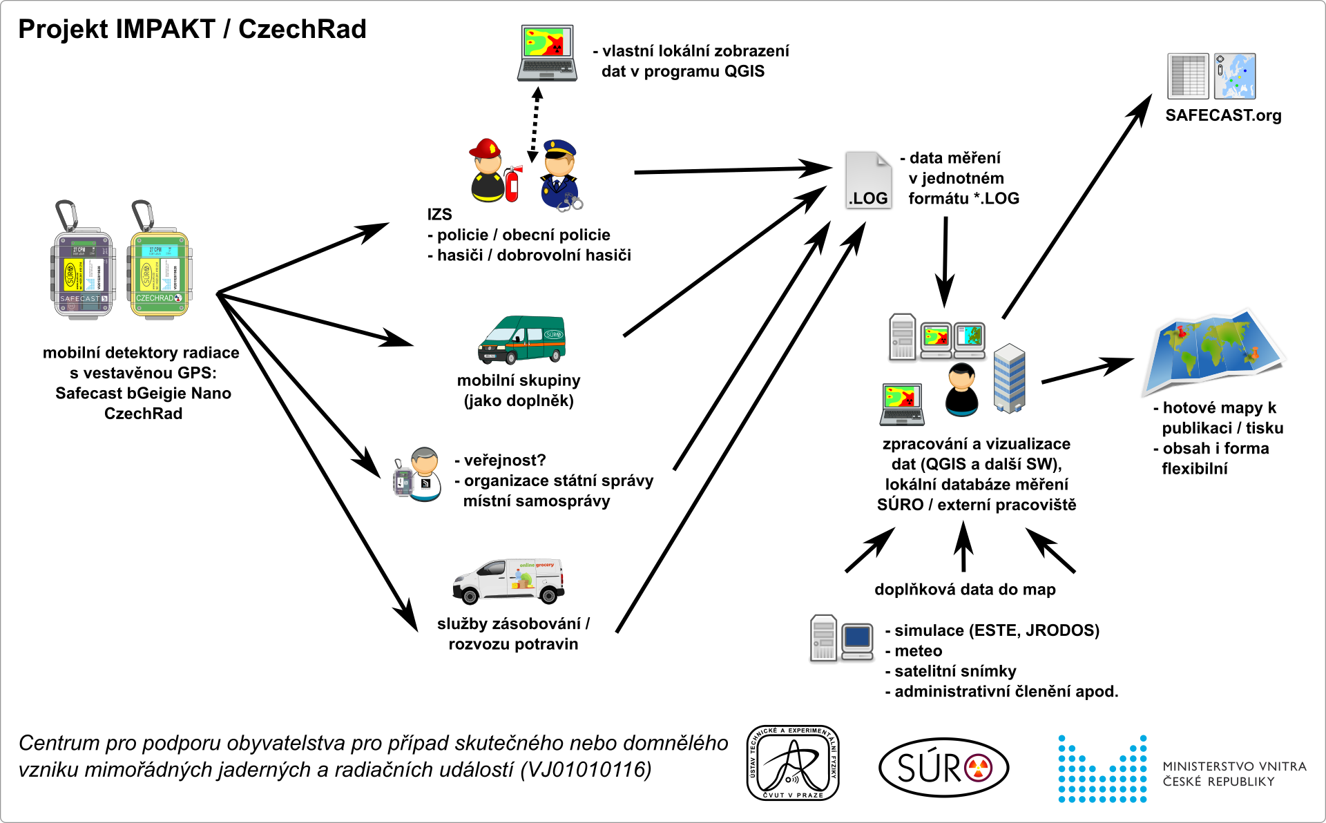
29. 1. 2024, 14:55
IMPAKT schema.png
(
soubor
)
473 KB
Jan.helebrant
2
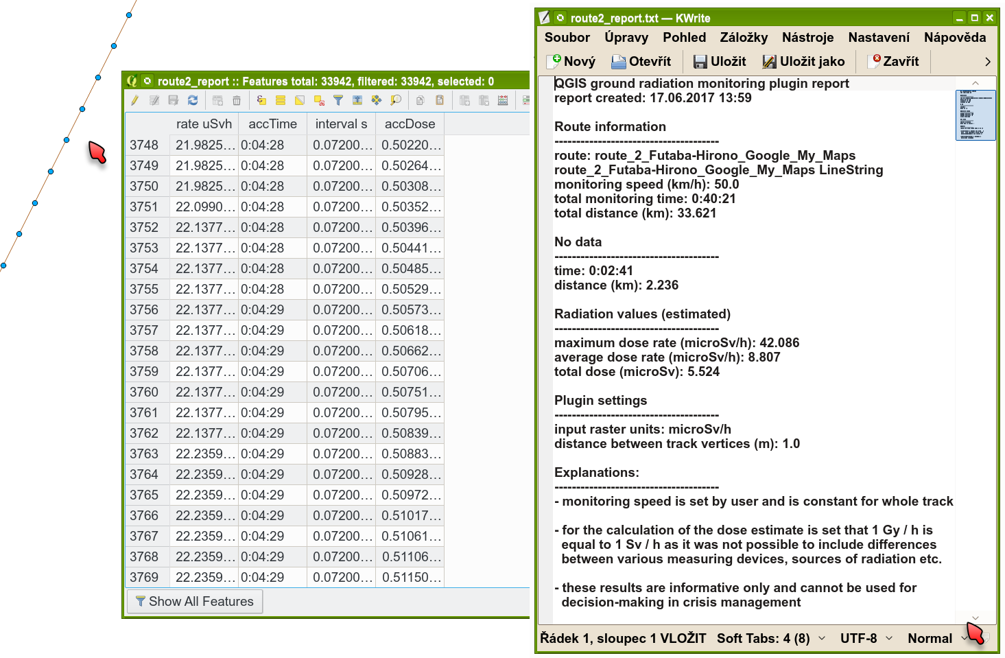
18. 4. 2024, 16:35
QGIS3 LOG data.png
(
soubor
)
499 KB
Jan.helebrant
1
14. 8. 2019, 14:49
Wiki ramesis fixni stanicka 3D pohledy.png
(
soubor
)
501 KB
Jan.helebrant
1
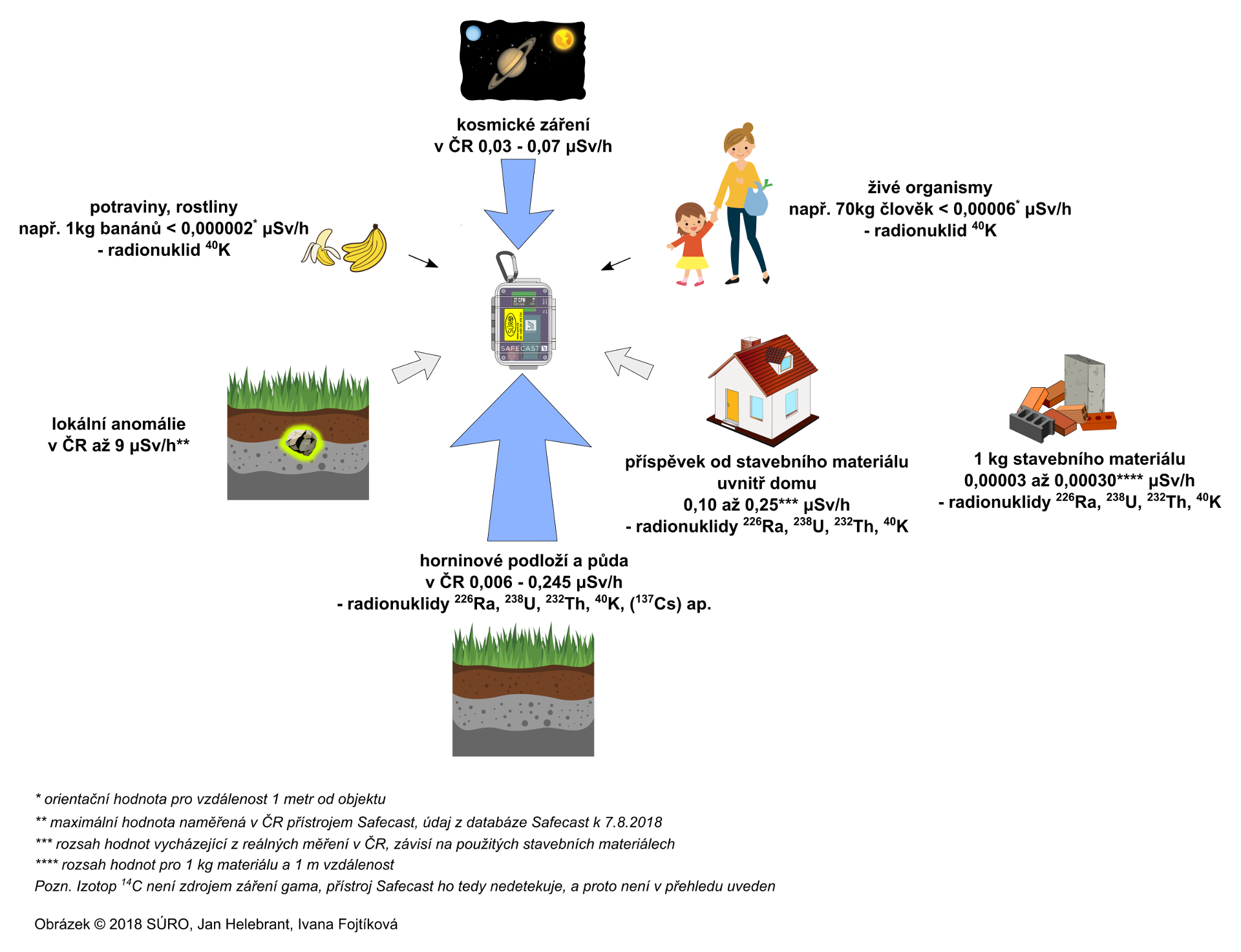
30. 10. 2018, 16:28
Zareni prirodni zdroje wiki.png
(
soubor
)
508 KB
Jan.helebrant
1
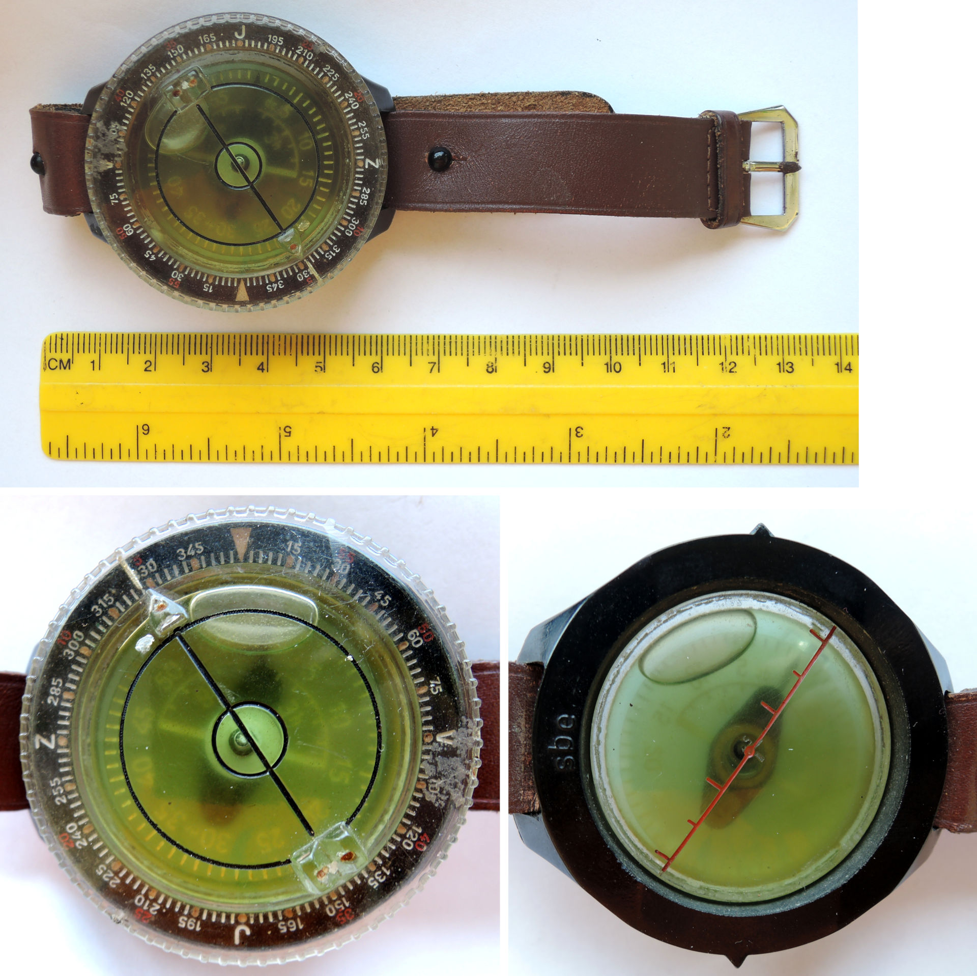
21. 8. 2019, 23:16
Kompas kolaz web.JPG
(
soubor
)
511 KB
Jan.helebrant
1
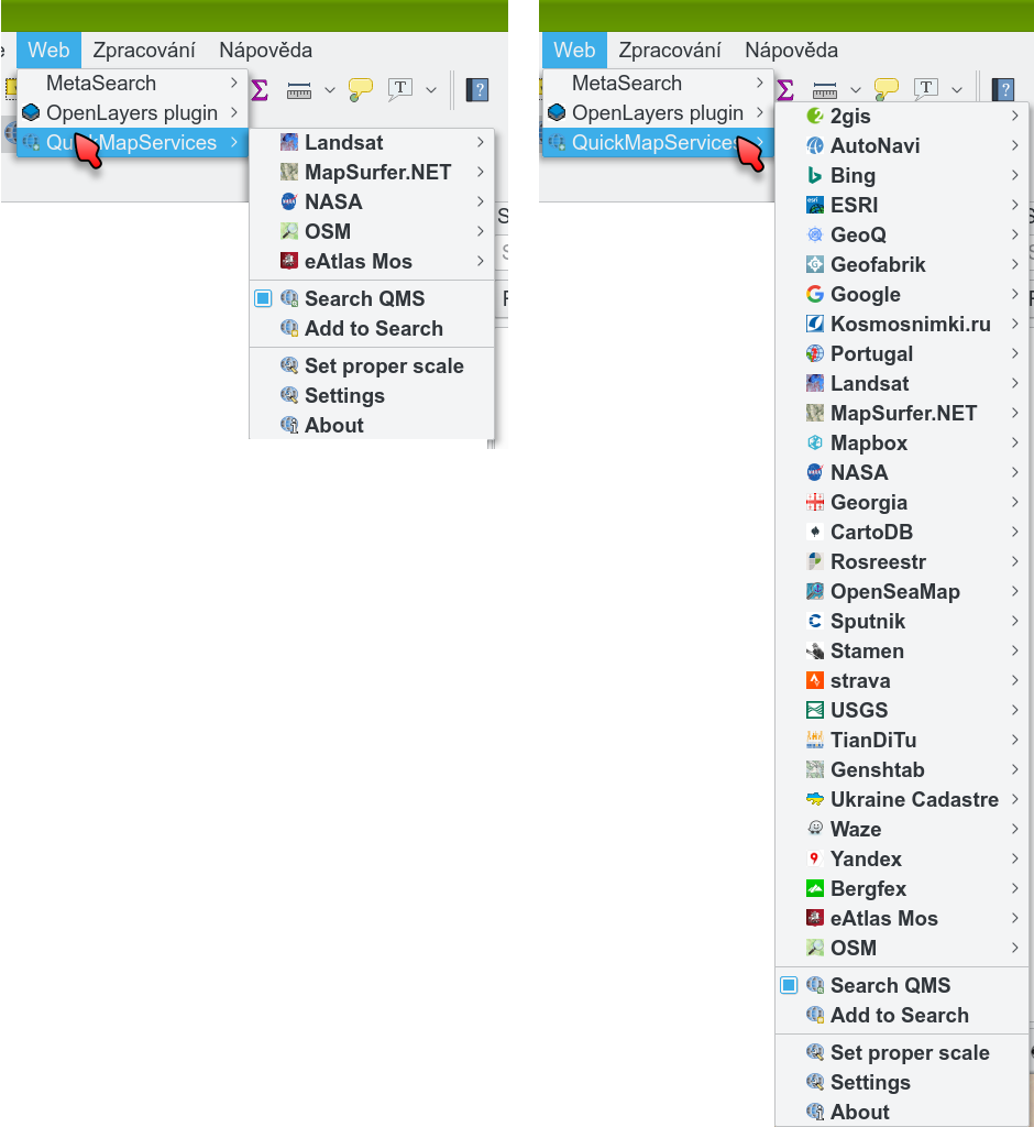
11. 3. 2019, 16:46
Quickmapservices menu QGIS contributed.png
(
soubor
)
525 KB
Jan.helebrant
1
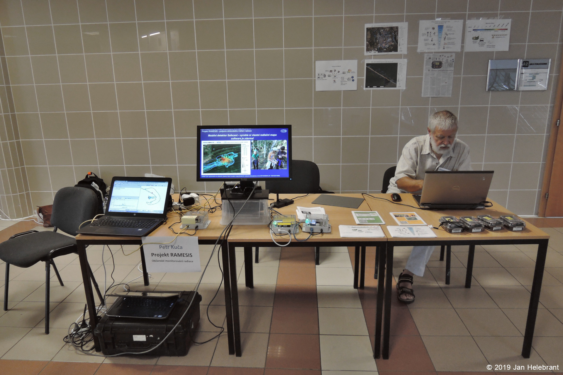
3. 9. 2019, 10:17
2019-08-31 VNUF RAMESIS 01.jpg
(
soubor
)
526 KB
Jan.helebrant
1
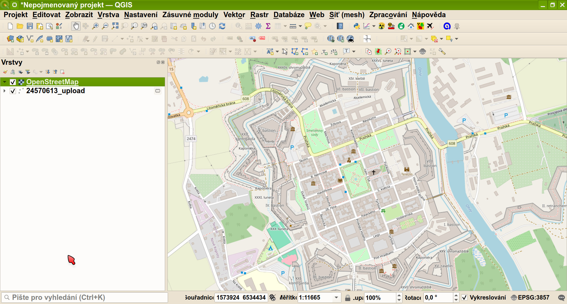
19. 4. 2024, 10:31
QGIS3 OpenStreetMap.jpg
(
soubor
)
527 KB
Jan.helebrant
1
21. 8. 2019, 22:50
Radiobaryt web.JPG
(
soubor
)
531 KB
Jan.helebrant
1
3. 9. 2019, 10:20
2019-08-31 VNUF RAMESIS 03.jpg
(
soubor
)
555 KB
Jan.helebrant
1
3. 9. 2019, 10:18
2019-08-31 VNUF RAMESIS 02.jpg
(
soubor
)
563 KB
Jan.helebrant
1
19. 4. 2024, 11:00
QGIS3 Safecast OpenStreetMap.jpg
(
soubor
)
574 KB
Jan.helebrant
1
21. 8. 2019, 23:11
Uranove sklo Safecast web.JPG
(
soubor
)
575 KB
Jan.helebrant
1
4. 6. 2018, 11:07
QGIS navrh mapy.png
(
soubor
)
591 KB
Jan.helebrant
1
1. 6. 2018, 11:41
SAFECAST demo OpenStreetMap Prirodniskola.jpg
(
soubor
)
598 KB
Jan.helebrant
1
21. 8. 2019, 22:37
Smolinec kolaz web.jpg
(
soubor
)
613 KB
Jan.helebrant
1
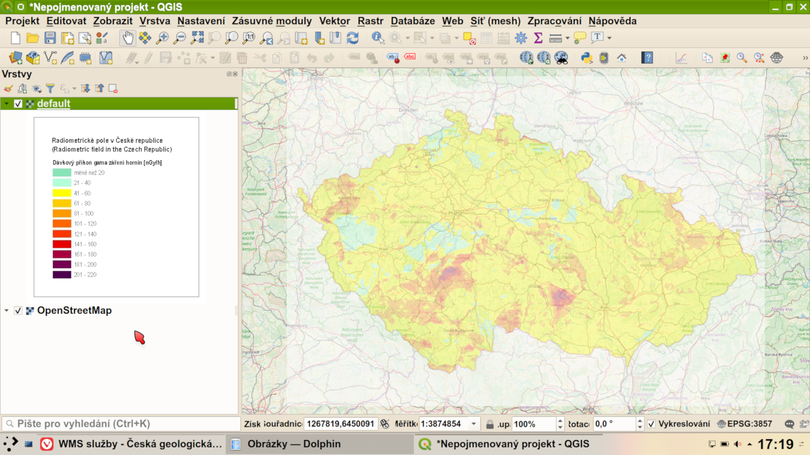
20. 2. 2020, 01:26
QGIS3 006 WMS radiometricka.png
(
soubor
)
707 KB
Jan.helebrant
1
22. 10. 2017, 21:20
UTEF detektory RAMESIS.jpg
(
soubor
)
802 KB
Jan.helebrant
1
20. 2. 2020, 01:49
QGIS3 010 WMS pruhlednost.png
(
soubor
)
864 KB
Jan.helebrant
1
14. 8. 2019, 14:54
Pixelove obr2.png
(
soubor
)
872 KB
Jan.helebrant
1
15. 4. 2020, 15:16
20200227 Slany02 res.jpg
(
soubor
)
908 KB
Jan.helebrant
1
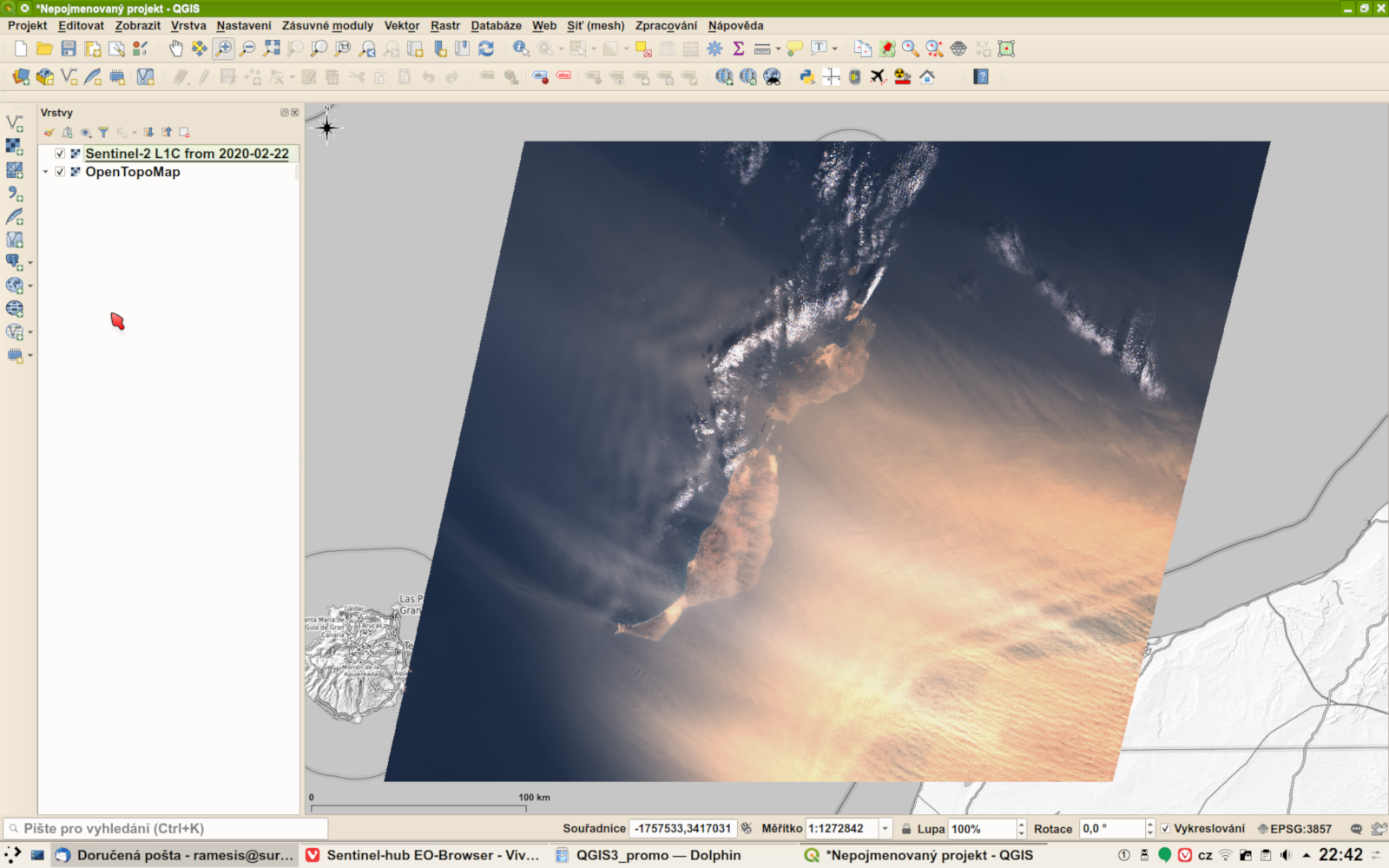
21. 4. 2020, 23:43
QGIS3 wiki Sentinel-2 Canary storm.png
(
soubor
)
923 KB
Jan.helebrant
1
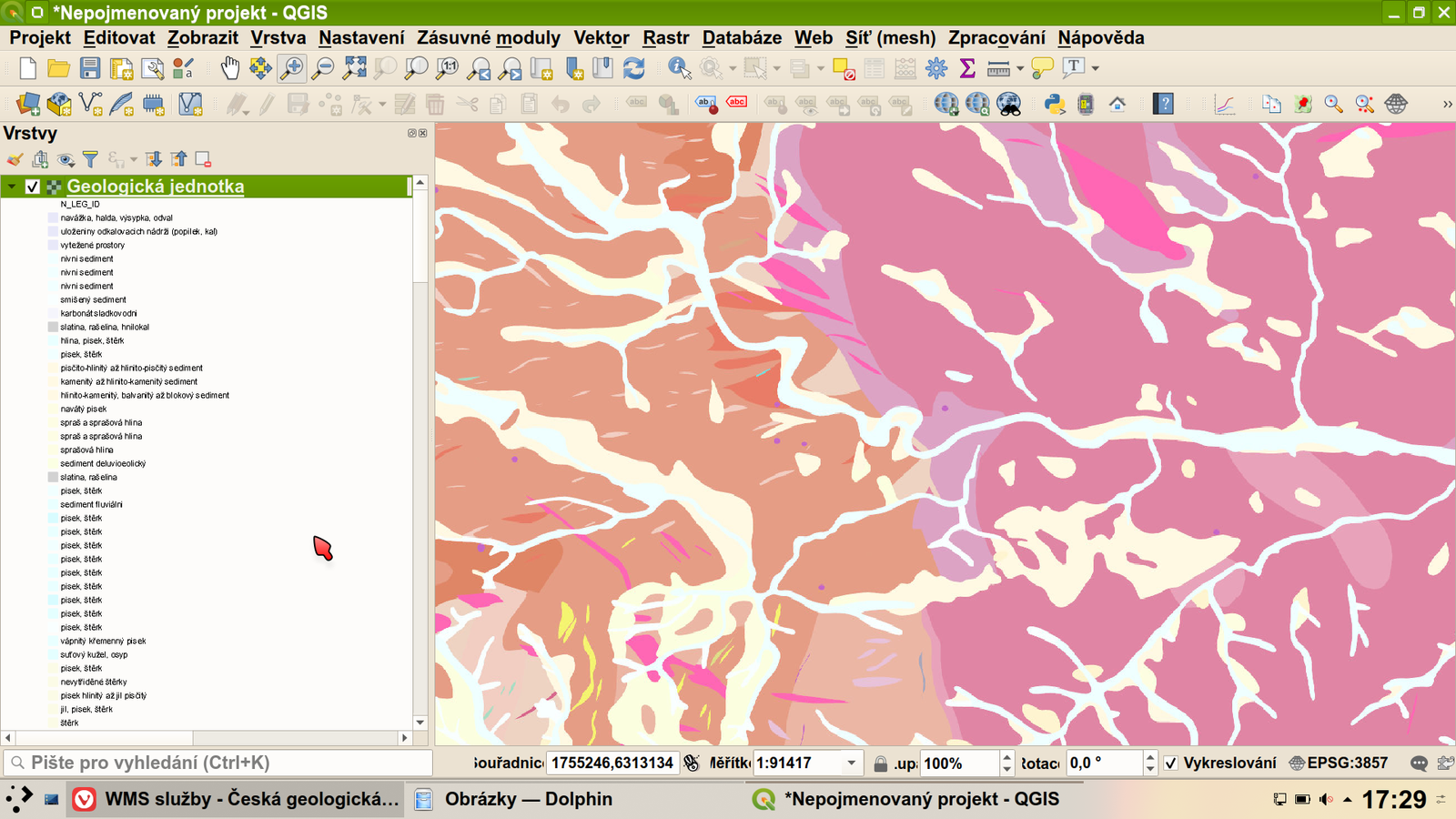
20. 2. 2020, 12:06
QGIS3 013 WMS geologicka.png
(
soubor
)
952 KB
Jan.helebrant
1
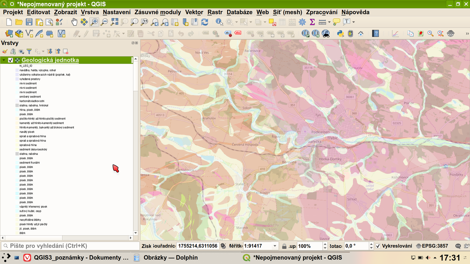
20. 2. 2020, 12:07
QGIS3 014 WMS geologicka pruhledna.png
(
soubor
)
1,24 MB
Jan.helebrant
1
20. 2. 2020, 01:47
QGIS3 009 WMS pruhlednost.png
(
soubor
)
1,38 MB
Jan.helebrant
1
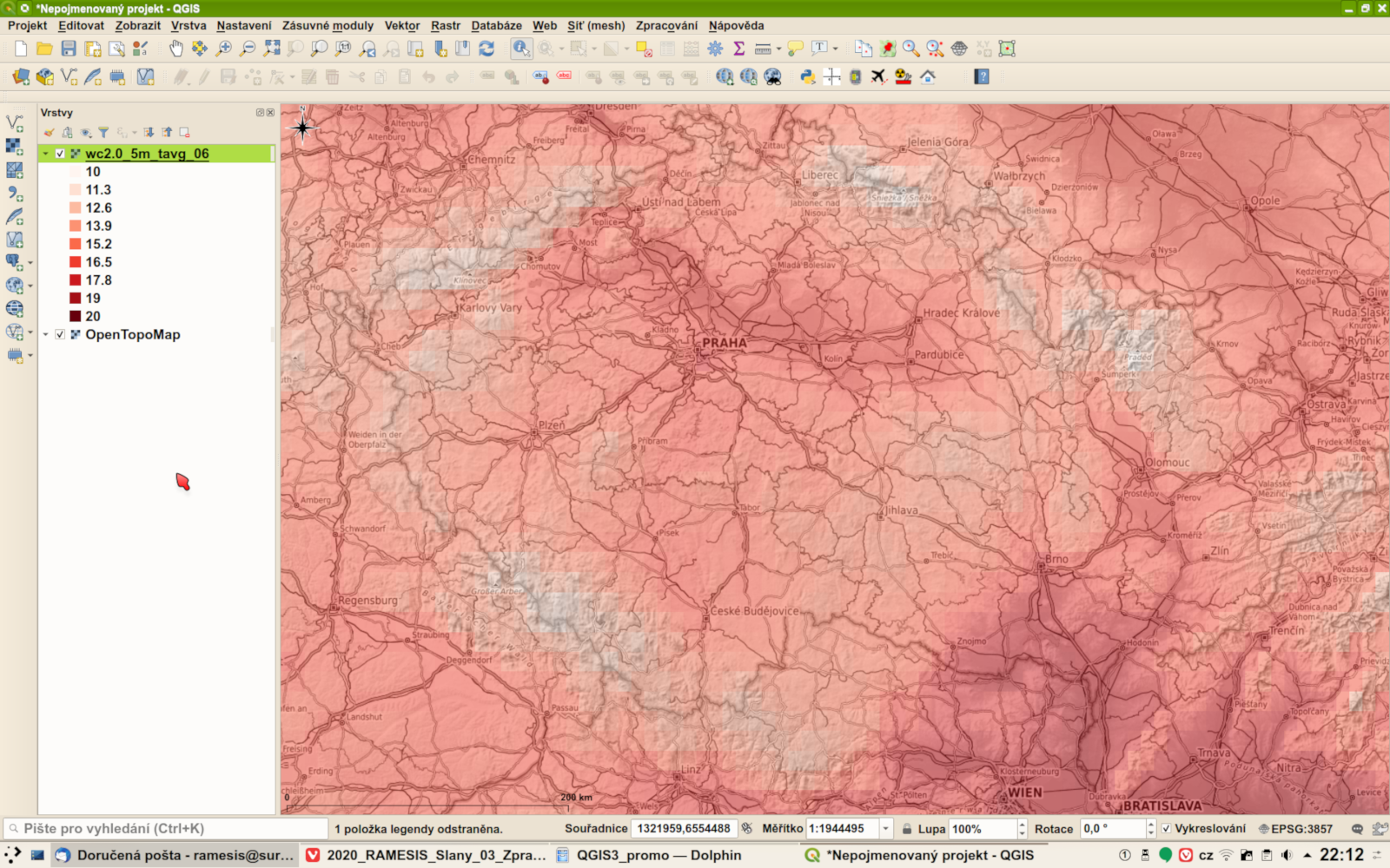
21. 4. 2020, 18:01
QGIS3 wiki WorldClim V2 tavg 5m 06.png
(
soubor
)
1,47 MB
Jan.helebrant
1
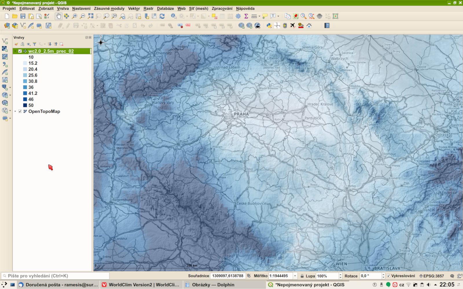
21. 4. 2020, 17:28
QGIS3 wiki WorldClim V2 precip 2.5m 02.png
(
soubor
)
1,48 MB
Jan.helebrant
1
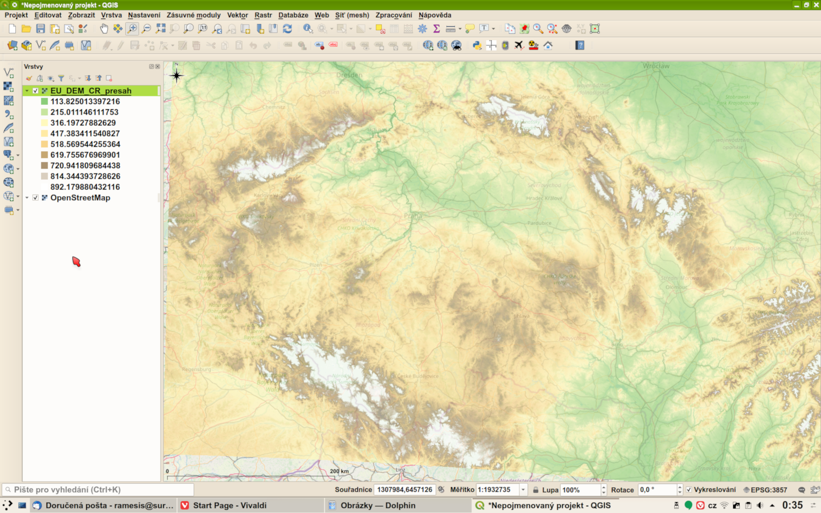
21. 4. 2020, 12:59
QGIS3 wiki model reliefu EU-DEM.png
(
soubor
)
1,68 MB
Jan.helebrant
1
První stránka
Předchozí stránka
Následující stránka
Poslední stránka
Navigační menu
Osobní nástroje
Přihlášení
Jmenné prostory
Speciální stránka
Varianty
Zobrazení
Další
Hledat
Navigace
Hlavní strana
Poslední změny
Náhodná stránka
Nápověda k MediaWiki
Nástroje
Speciální stránky
Verze k tisku


